GIS Local
Sistemul Informațional Geografic de Stat la Nivel Local pentru Autoritățile Administrației Publice Locale
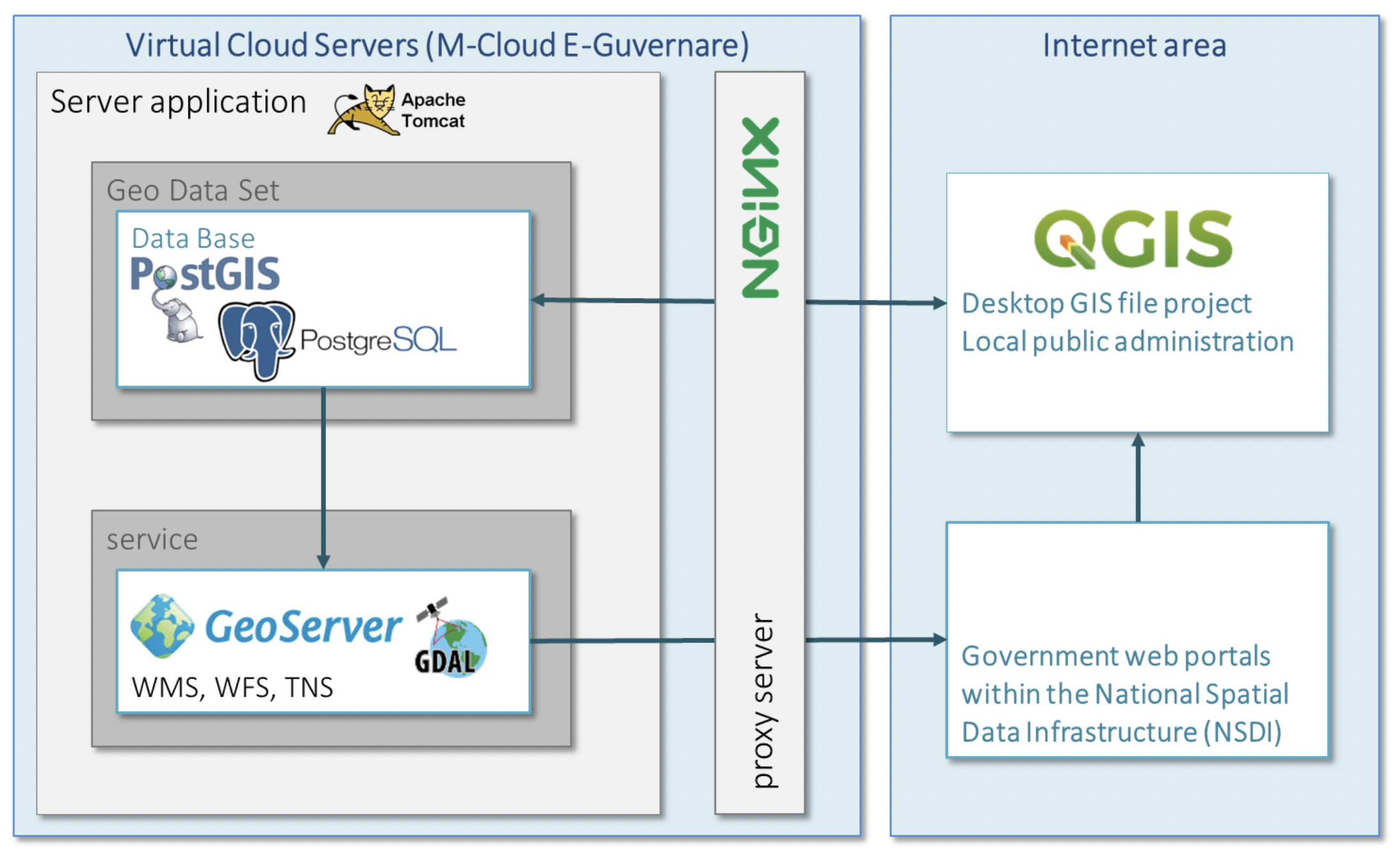
Architecture:
 From their guide here
PostGIS
- PostgreSQL with PostGIS extension: allows you to store geospatial data in PostgreSQL
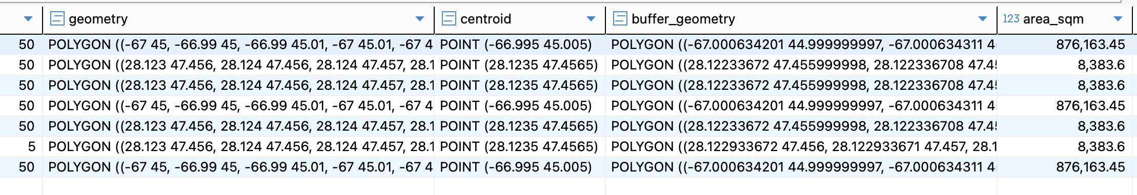
PostGIS opens up the ability to store your data in a single coordinate system such as WGS84 (srid-4326), and when you need something like Area, Distance, or Length, you use a function to create that column from your data in a projected coordinate system that will give you a local interpretation of your data in units that you want.
From https://gis.stackexchange.com/a/131372
Snippet from the database rows:
GeoServer
- GeoServer - open-source server in Java for sharing geospatial data
It has a web administration interface, useful for tasks ranging “from adding data to changing service settings”.
How it connects to PostGIS as a data source: https://docs.geoserver.org/main/en/user/gettingstarted/postgis-quickstart/index.html
Using the WFS (Web Feature Service) provided by Geoserver - https://docs.geoserver.org/latest/en/user/services/wfs/reference.html One can fetch data, update feature geometry, add new feature.
With REST on can add a new layer, upload new dataset, change layer style.
For the thesis scope, it seems that the WFS will be enough, as the sites represent one layer with more features.
QGIS
QGIS - desktop tool to view maps , edit layers, analyze data. One can add PostGIS as the data source. Free and open-source.
Geodata
They provide different maps, including the arhchaeological sites one.
MapStore
Mapstore (GitHub Repo), which provides a web interface as well:
 Documentation. Uses React.
On the server side, the requests indicate they use Geoserver too.
Asumption: it uses the same data from the geoserver instance of GisLocal.
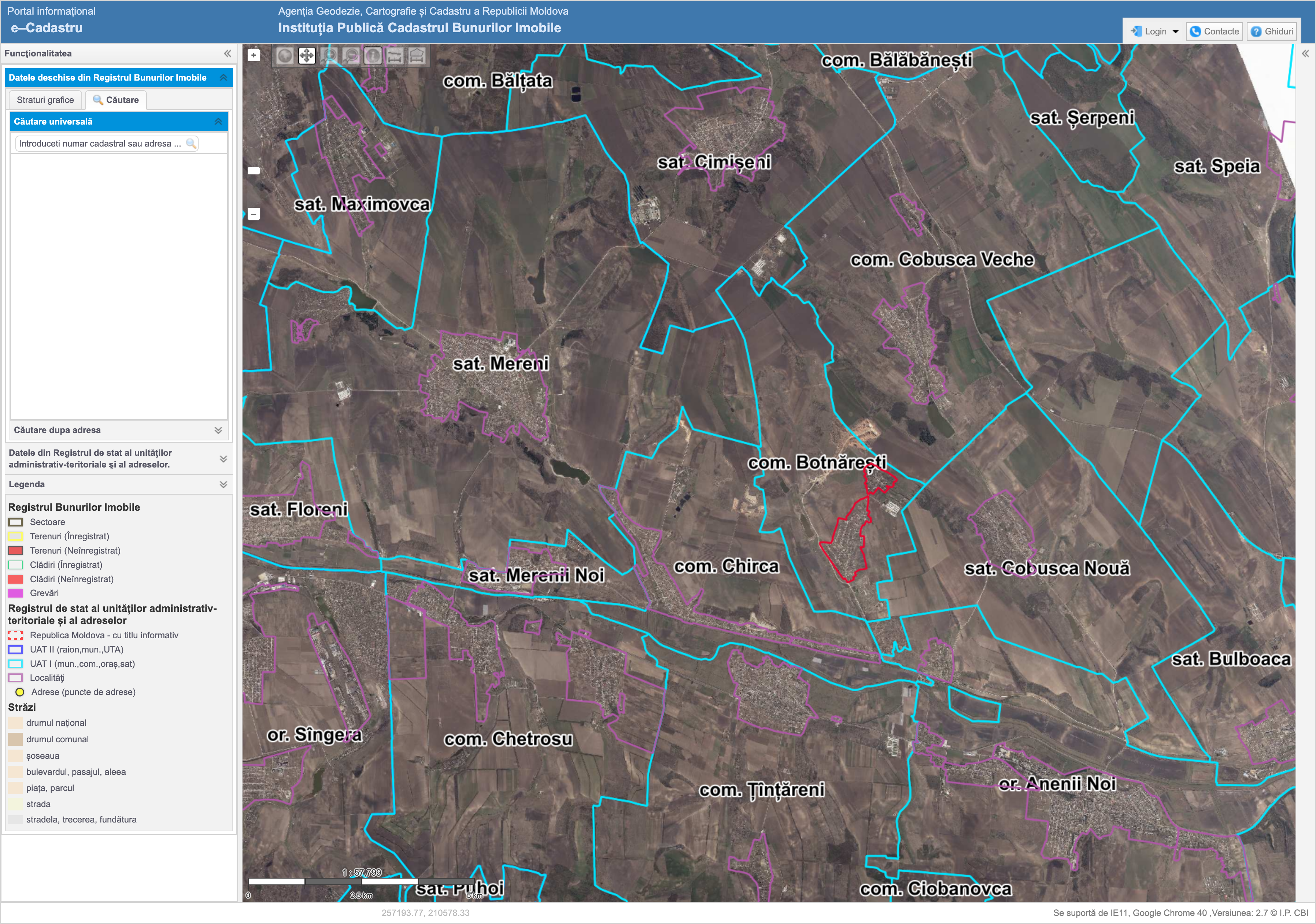
e-cadastru
Also uses Geoserver.
Romania
They use MapServer.
1. MapServer is generally better when dealing with WMS, while GeoServer deals better with WFS. 2. A big difference is that GeoServer supports WFS-T, that it Transactional WFS (editing of feature services on the client side), while MapServer dont. 3. Mapserver works with CGI, GeoSever with J2EE. That may entail some advantage to GeoServer, since some companies dont want to work with CGI. 4. MapServer is a more mature project (1996), while GeoServer is a bit more recent (2003). 5. GeoServer has a web tool administration that eases configuration. 6. MapServer has without any doubt a very powerful cartography system, providing data under dynamic vectors with high quality 7. None of them is better or worse. The development objectives are different. 8. PHP Mapscript for Mapserver, which provides a powerful scripting interface for PHP programmers. For Java programmers, Geoserver might be a better choice
From https://mapserver-users.osgeo.narkive.com/P2vwzUlo/mapserver-vs-geoserver
The tools used are open-source and focused on interoperability.